Altus Dexter’s UAS service includes the deployment of drones for various applications relevant to the industrial, energy, commercial, agriculture, residential, real state, health, mining, and government sectors. This can include photography and videography, aerial mapping and surveying, security and surveillance, disaster, and emergency response. It also includes inspection and maintenance of critical infrastructure: power lines, pipelines, wind turbines, solar panels, roofs, towers, process facilities, etc.
The service is delivered by FAA certified remote pilots, and operations are conducted according to the requirements of Part 107 of the Title 14 of the Code of Federal Regulations (14 CFR 107), with appropriate safety protocols and procedures.
Drones can significantly reduce the cost of inspections and imagery, when compared to those performed from manned aircraft, at reduced complexity and time. Also, businesses of various sectors can benefit from enhanced efficiency and safety in their operations, as drones can reduce the need for manual or visual inspections, or augment capabilities when used with advanced sensors on board (lidars, radars, infrared, gas, particles, etc.). The ability of drones to access hard-to-reach is, in many cases, unattainable by other means.
Infrastructure Inspection and monitoring involves deploying drones equipped with advanced imaging and sensory technology (high resolution, thermal, LIDAR) to inspect, monitor, and collect data on various types infrastructure:
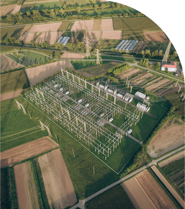
Power Line and Utility
Identification of damaged or overheated components in power lines, substations, and distribution systems. Predictive maintenance via thermal or visible camera sensors. Vegetation inspection.
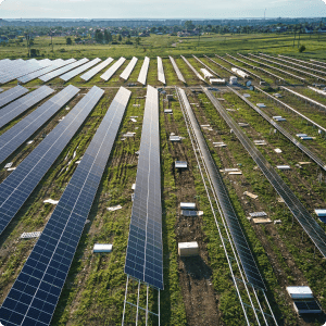
Solar farms and solar roofs
Identification of defective, underperforming, or underused solar cells, modules, or strings, with the use of thermal and visual sensors, along with specialized software. Inspections pinpoint issues such as cracks, shading, or soiling that reduce the overall efficiency of the solar system.
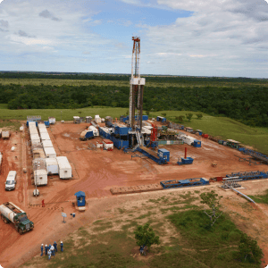
Industrial inspection
For detecting leakages, corrosion, or structural issues, inspections are performed in heat exchangers, chimneys, towers, columns, and other process equipment. Tanks and vessels can also be inspected, both internally and externally.
Pipeline
Monitoring for leaks, corrosion, and other forms of damage. Inspection and mapping of surrounding terrain.
Wind turbine, antenna,
and tower inspection
Monitoring for wear, tear or damage in blades, towers, nacelles, antennas, towers, and obstruction lights.
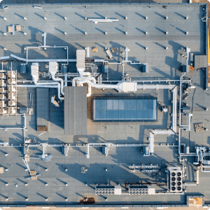
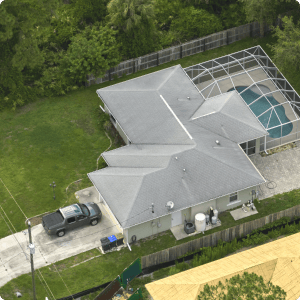
Rooftop inspection
High resolution and thermal cameras are used to detect poor insulation, water leaks, damage, structural issues on rooftops of residential, commercial, and industrial buildings.
Inspections of bridges, buildings and monuments
Provides detailed visual and thermal imagery to identify structural problems, water damage, or thermal inefficiencies in elevated or hard-to-reach places.
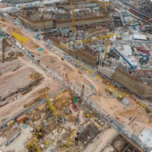
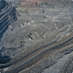
A combination of image sensors and software perform aerial 3D mapping, surveying, or photogrammetry. Most common uses include construction site assessment, development and monitoring, topographic mapping, stockpile and volumetric measurements, and agriculture.
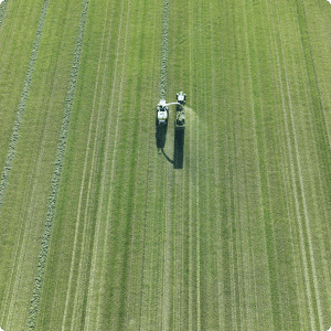
Agricultural services
“AG-drones” are used to cost effectively monitor and manage crop health, livestock, soil, and irrigation, with the use of special sensors like multi spectral cameras, thermal imaging, and software.
Aerial photography and videography
Captures high-quality aerial photographs and videos for various purposes, including real state promotion, event coverage (weddings, sport events, concerts), film and commercial production.
Insurance and damage assessment
High resolution images and videos provide fast and cost-effective means to assess post disaster damage, evidence for insurance claim validation, or risk management (accidents, floods, storms, structural damage).
Crowd management
Augmentation of safety during public and private events by crowd and traffic monitoring. Aerial views of concerts, festivals, sporting events, or public gatherings, offering real-time insights into crowd density, flow, and behavior; helps event organizers and security personnel make informed decisions to prevent overcrowding, manage queues, and ensure swift emergency response.